01 / What we can do today
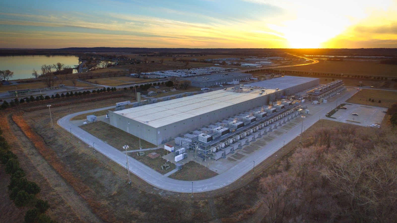
Where landscape and big infrastructure meet.
We work with operators whose assets sit on moving ground. Understanding the Earth is central to safety, cost, and climate risk.
AEI turns modern geophysical data and AI into live insights on the ground beneath critical infrastructure for climate and natural hazard decisions.
We work with operators whose assets sit on moving ground. Understanding the Earth is central to safety, cost, and climate risk.
Ground-based sensing is our edge. We leverage dense geophysical networks and satellite data fused with physics-based AI models to provide actionable insight for the people managing critical assets.
Geophysical networks including seismic and fiber sensing combine with satellite data to build one coherent picture of the landscape over time.
Earth physics, not curve-fitting alone. Models that explain observations and hold up under scrutiny.
Machine learning resolves messy, high-volume geophysical data into patterns and insight operators can act on.
Robust, auditable AI pipelines that show their work from raw signal to action.
Field data is messy, disaggregated, and incomplete. Our AI pipelines are agentic but never opaque. AEI gets the most out of the data and infrastructure you already have while staying grounded in earth science, robust to noise, and auditable from end to end.
Continuous data from ground networks and satellites streams in.
Sources are aligned in space and time into one coherent record.
Physics and AI-based models infer what's happening beneath the surface.
Results render as live analytics and imagery of the ground and its behavior.
A traceable alert or assessment, with the evidence attached.
Every result traces back to the raw signal that produced it.
Confidence travels with the answer, never a number without a margin.
Built for real field conditions with gaps, drift, and bad sensors included.
Evaluations are a core principle, not an afterthought. We measure what we ship.
AI is the instrument, not the decision-maker. We build augmented intelligence that keeps humans centered while providing deep geophysical reasoning in language people can act on. AEI lowers the barrier between science and action, helping teams use complex data instead of black-boxing it.
Our data streams include seismic arrays, fiber sensing, and satellite imagery, with room for additional geophysical networks and integration with existing sensors.
Infrastructure is usually monitored either from the ground or from space. AEI brings both views together, adds physics and machine learning, and turns the combined picture into decision-ready insight. That's why our picture holds together where single-source, data-only tools fall apart.
AEI was founded out of the University of Washington's FiberLab, where the novel research behind our platform continues every day.

Cofounded AEI to bring modern geophysical sensing to real-world problems. Leads fundraising, partnerships, and commercialization of AEI's innovative solutions.

Principal investigator of UW's FiberLab, applying novel fiber sensing techniques to geophysics. Leads geophysical data analysis, physics-based modeling, and technical strategy.

Builds AI-powered big-data pipelines to characterize geophysical systems. Leads AI integration, software and model development, and data-processing strategy.
Tell us about your site or network and we'll get back to you to scope a demo. Partners, operators, and investors welcome.